
(Click to enlarge)
The Bachelor of Science Meteorology Program at Western Kentucky University, housed within the Department of Geography and Geology, is currently the only meteorology program in Kentucky and Tennessee that meets all Federal Civil Service requirements for employment by the National Weather Service and enables broadcast meteorologists to immediately pursue the “Certified Broadcast Meteorologist” program of the American Meteorological Society upon graduation. The program is facilitated by a variety of atmospheric science centers and laboratories, including the College Heights Atmospheric Observatory for Students (CHAOS), the Kentucky Mesonet, and the Kentucky State Climate Center. Faculty and students within the WKU Meteorology Program also maintain close working relations with the National Weather Service-Louisville and other nearby offices for lectures, workshops, storm surveys, and student employment.
The emphasis of the WKU Meteorology Program is on advanced theoretical and applied coursework, coupled with student engaged, hands-on active learning with meteorological instruments, field work, and data visualization. Students undergo extensive training in each course using a variety of Unidata and other software for data visualization regarding forecasting and research applications.
With the goal of continuing to professionalize the learning experience at WKU, my colleague Dr. Eric Rappin and I sought a Unidata Community Equipment Award for support in implementing AWIPS II for a contemporary/enhanced approach toward meteorological education and research. During the fall 2015 semester, the WKU Meteorology Program installed a new EDEX server and three CAVE clients to test the AWIPS II system. Upon installation, a variety of students, faculty, and staff explored the software capabilities to provide feedback to and seek further support from Unidata for potential improvement of subsequent release versions.
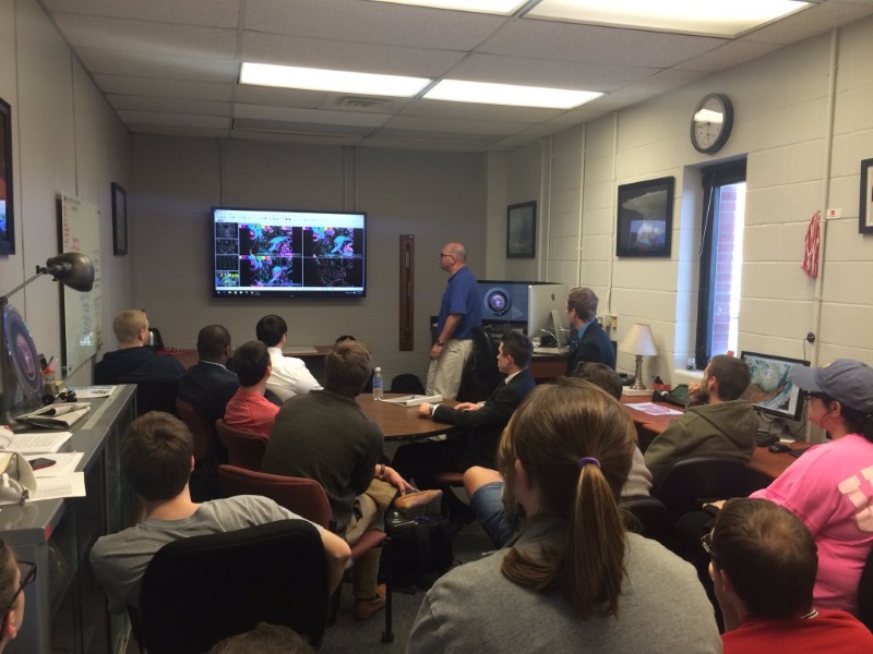
In March 2016, Mark Jarvis, Lead Forecaster with the NWS in Louisville visited the WKU Meteorology Program to provide an AWIPS II training workshop. Participants were afforded the opportunity to look beyond the face value of AWIPS II and learn the deeper capabilities and powerful forecast visualization options of the software.
“The National Weather Service AWIPS II Workshop was an excellent preparatory experience for use of the software,” said Pierce Larkin, a 3rd year B.S. Meteorology Major who attended the training. “The information was detailed, informative, and critical to understanding the software when we gained access to it at WKU. The seminar gave me insight into how to effectively use the software, and how to troubleshoot issues that I have. Moreover, as a volunteer at the NWS-Louisville office, having AWIPS II experience has given me a great running start at the office!”
Another exciting exercise related to AWIPS II implementation at WKU included examination of data visualization design and output with a Tobii X2-60 Eye Tracker. In a pilot study, we worked with experienced and non-experienced AWIPS II users to evaluate the software design and usability, as well as the package's visualization of fundamental meteorological output. This eye-tracking technology provided the ability to quantitatively measure an individual's points of interest and precise eye movements with 2D or 3D visualizations. Specific eye movements were statistically correlated to the attention path demonstrated by student observers. In a forthcoming formal study, we plan to provide feedback from using eye-tracking approaches toward understanding software design and meteorological education and understanding.
“The eye tracker experience revealed to me that I was understanding the meteorology, weather analysis, and data visualization in a way that was becoming natural. This was made possible with the well-designed graphic quality of AWIPS II, which enabled map analysis to be a relatively easy and simple process,” said 3rd year B.S. Meteorology Major Christopher Reece, who participated in the pilot study.
Looking ahead, our goal is to implement additional methods of data retrieval, including the use of the onsite NOAAPort system at WKU and Python data access methods. Currently, students and faculty are heavy users of the Unidata software suite (e.g., IDV, GEMPAK, McIDAS) for daily forecast discussions, instruction, class assignments and exams, and research. The overarching goal is to compliment these utilities by providing access to AWIPS II as a fundamental weather and climate analysis tool at the start of the 2016-17 academic year.
Unidata Community Equipment Award grants make funds available to colleges and universities to puchase equipment or cloud-based computing services that will enhance their participation in the Unidata program. For additional information on program, visit the Equipment Awards page.