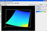
The GES DISC has recently added new capabilities in OPeNDAP that
enable IDV to visualize Atmospheric Infrared Sounder (AIRS) data in
HDF-EOS, including AIRS Level-2 and Level-1B datasets (see below for a
screenshot thumbnail). Level 3 (gridded) data from AIRS are also
available.
AIRS is an atmospheric sounding system of infrared, microwave and
visible sensors that provides temperature and moisture profiles, as
well as some trace gas burdens/profiles. For more information, see http://disc.sci.gsfc.nasa.gov/AIRS
and http://airs.jpl.nasa.gov/.
GETTING AIRS DATA THROUGH OPENDAP:
You can go directly to the OPeNDAP tree for the AIRS products by
beginning at
http://disc.sci.gsfc.nasa.gov/AIRS/data-holdings/by-access-method.
However, as much of the newly available data are scene-based, you may
want to do a space-time search to find your scenes of interest. The
Mirador search tool (http://mirador.gsfc.nasa.gov/) allows you to do
that search and then link through to the corresponding OPeNDAP URLs
(Data Access Form) corresponding to individual data files in your
results (see screenshot below).

The "Data URL" from the OPeNDAP Server Data Access Form can be cut and
pasted into the Data Chooser for URLs, e.g.:
http://airspar1u.ecs.nasa.gov/opendap/Aqua_AIRS_Level2/AIRX2RET.005//2010/158/AIRS.2010.06.07.150.L2.RetStd.v5.2.2.0.G10159122120.hdf
Data Source Type is "Grid files (netCDF/GRIB/OPeNDAP/GEMPAK)", even
for the L1 and L2 swath.
(All the data are available free of charge.)
Acknowledgments: These new OPeNDAP capabilities were developed by The
HDF Group, at http://www.hdfgroup.org/ (thanks, guys!).
--
Christopher Lynnes NASA/GSFC, Code 610.2
301-614-5185