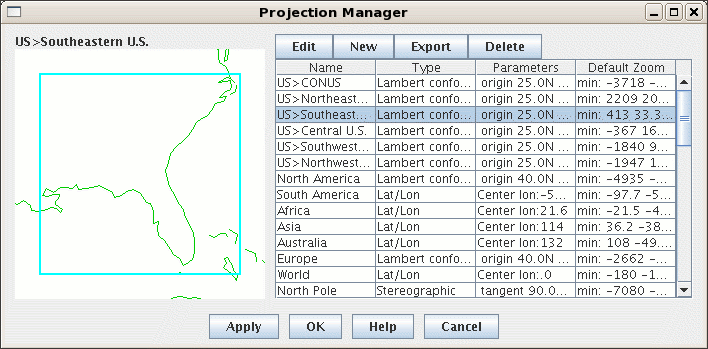
Image 1: Projection Manager


A projection is a way of mapping the surface of the earth (a curved 2D surface) onto a plane (a flat 2D surface). A projection transforms a point on the earth (specified by latitude, longitude) to a point on the projection plane .
In the Projection Manager, both the projection -- which kind of mapping to use -- and the area of the Earth can be specified. You can make a Lambert Conformal map of North America, and a Lambert Conformal map of Sedgwick County, Kansas. Same projection, different areas.
The IDV provides four basic types of projections: Lambert Conformal, Transverse Mercator, Stereographic, and Cylindrical Equidistant (the last is a special projection for datasets in Lat/Lon coordinates which deals with longitude wrapping around the cylinder). Each of these can be parameterized (e.g., tangent point, origin longitude) to create a specific projection area of that type. When you define a projection and area, you specify the type of projection and its parameters.
Projections->New/Edit
menu option. Projections supplied with the IDV are shown in the list.
There may be additional projections you have created and named.
In the figure, the IDV North American projection is highlighted,
and displayed on the left.

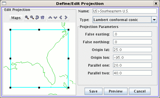
To modify or create a new projection: choose Edit or New from the menu; the Define/Edit Projection dialog box appears (see below).
The IDV starts with a default projection. Use the Default pull-down menu to select the projection that will be shown each time your IDV starts. (The default projection may not be used if you are starting the IDV with a Bundle of configuration information.)
You can also Export a projection to a file.
Here is how to create a new or revised projection:

In the example shown, a Lambert Conformal projection is being defined with the projection parameters as shown in the figure.
You can remove any projection from the main list by clicking on its name to highlight it, and then clicking on the Delete button.